(Day 28) Bahir Dar to Lalibela – 27 April 2011
Distance for the day – 312 km Odometer – 9 605 km
Hours on the Bike – 05:03
Donations up to date for Adelaide Hospital – R 77 327.00
We left Bahir Dar rather late because of the Blog that had to be updated first. We have now discovered that our modem is not compatible with the Ethiopian setup and will have to rely on Internet Cafe’s. Ethiopia does not have data connectivity and therefore the “where are we now” feature on the blog does not work. Ethiopia has a cheap and effective network and we believe that their government is doing its best to help their people to connect with the world. There are numbers of internet cafe’s in even some of the rural towns, we saw. It might be a small 10 m² tin building with two or three computers in them. Our Blackberry service does also not work probably because of the same reasons regarding data connectivity.
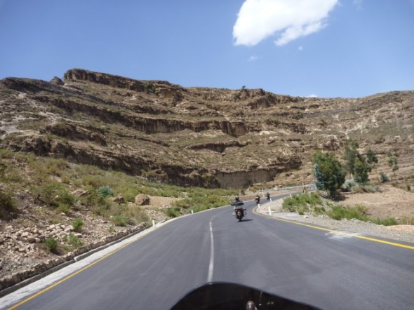
The first few km’s out of Bahir Dar along Lake Tana was similar scenery to what we have seen before, but it gradually changed the further we went up north in the direction of Gonder. It became more mountainous and much drier. The road kept climbing and we reached a new maximum height of 3 258 m for the trip so far. As far as the eye could see there were rows and rows of mountains and the cameras were clicking away. What was fascinating was that even in these highly remote areas there were people cultivating the mountain slopes, making terraces by packing stone by hand.
We again had bike problems with Richards bike losing all electrics. It was discovered that his charger was causing a short in the wiring circuit which caused a main fuse to blow. A plan was made and we were off again. Norman also realized that his one front shock was starting to lose oil and Stelios complained that his back brake was not functioning properly.
We sensed a change in the people’s attitude towards us in the more isolated villages deep in to the mountains, with the odd remark shouted at us, some even spitting at us and we all were hit by stones that were thrown at us. Maybe they do not like these noisy “Piki-Piki’s” to intrude their privacy?
We turned off the tar road with about 63 km’s left to Lalibela onto a dirt road which definitely was the highlight of the tour so far, scenery wise. The road crept through valleys and over mountains with views that was unimaginable. It reminded you a little of the Lesotho Highlands.
We reached the town of Lalibela high up the Ashetem Mariam Mountains and started looking at options for accommodation. There are a number of different choices and we decided to go for the Mountain View Lodge, just because of the name. This definitely proved to be the right choice with views that will take your breath away.
Tomorrow we will take the day off and visit the ancient churches of Lalibela.


Ek is so bly dit gaan goed met julle almal, dit klink en lyk of julle dit baie geniet. Op al die foto’s is glimlaggende gesigte en dit lyk of geen probleem vir julle te groot is om op te los nie!! Rufus jou foto’s is asemrowend, jy is elke keer die regte tyd op die regte plek, dit is verskriklik mooi, veral die sonsondergange en ook die landskappe – ek gaan sommige probeer skilder een of ander tyd!
Baie groete aan almal.
Al die Loretz’e
April 29, 2011 at 19:36